Structural interoperability
Last updated on 2026-07-14 | Edit this page
Overview
Questions
- What is structural interoperability, and what does it allow software to do?
- How do data models, file formats, schemas, conventions, and access methods differ?
- How can simple tabular formats such as CSV and TSV support reusable, machine-actionable data?
- Which structural standards are appropriate for common climate and atmospheric data types?
- What structural contract does the NetCDF data model provide?
Objectives
- Explain structural interoperability as a shared, machine-actionable agreement about how data elements are organised and related.
- Distinguish between a data model, encoding or file format, schema, community convention, and access method.
- Evaluate the structural strengths and limitations of CSV/TSV, Parquet, NetCDF, Zarr, GRIB, and GeoTIFF.
- Identify the additional information needed to make tabular data reliably reusable across tools.
- Analyse a NetCDF dataset by identifying its dimensions, coordinate variables, data variables, attributes, and data types.
What is structural interoperability?
Structural interoperability concerns the organisation and representation of data: what kinds of data objects exist, how they are encoded, and how their relationships are expressed.
A dataset is structurally interoperable when different software tools can reliably:
- open and parse it using a published specification;
- locate records, columns, arrays, variables, coordinates, and metadata;
- determine data types, shapes, dimensions, and relationships;
- distinguish data values from missing or fill values;
- validate the dataset against explicit rules; and
- transform or subset it without relying on undocumented, dataset-specific assumptions.
A useful guiding question is: Can another tool determine how the dataset is organised and process that organisation without bespoke instructions from the person who created it?
This does not mean that a machine automatically
understands the scientific meaning of every value. Structural
interoperability makes the organisation machine-actionable; semantic
interoperability addresses whether terms such as
precipitation_flux, rainfall_rate, or
DBZH are defined and interpreted consistently.
Structural interoperability is a contract, not a file extension
A file extension such as .csv, .nc,
.tif, or .zarr is only a label. Structural
interoperability depends on several related layers working together.
| Layer | Question answered | Example |
|---|---|---|
| Data model | What kinds of objects exist, and how are they related? | Rows, columns, and cells; or dimensions, arrays, coordinates, and attributes |
| Encoding or format | How is that model represented as text or bytes? | Comma-delimited text, NetCDF binary encoding, Parquet column chunks |
| Schema | Which fields or variables are expected, with which types and constraints? |
station_id is a required string;
temperature is a number |
| Convention or profile | How should a community use the model and metadata consistently? | CF Conventions for NetCDF; CSVW metadata; Cloud Optimized GeoTIFF |
| Access method | How are the bytes or logical data objects retrieved? | Local file access, HTTP, OPeNDAP, object storage, HTTP range requests |
These layers should not be treated as synonyms.
- NetCDF defines a data model and one or more encodings.
- CF Conventions add rules for describing scientific variables, coordinates, units, and grid mappings within that model (see this episode)
- OPeNDAP is an access protocol that exposes remotely stored data for subsetting and retrieval.(see this episode)
Similarly, a CSV file defines a simple textual representation, but its structure becomes more reliable when a schema describes the columns, types, constraints, missing values, and dialect.
A useful test: can the structure be validated?
A structurally interoperable dataset should have enough explicit rules for a validator or reader to detect problems such as:
- a missing required column;
- a value with the wrong data type;
- an array whose dimensions do not match its declared shape;
- an undefined coordinate variable;
- an invalid fill value;
- inconsistent chunk metadata; or
- missing georeferencing information.
If correct interpretation depends mainly on a README, an email, or knowledge held by the original researcher, the structural contract is incomplete.
Structural interoperability is about data models, not only formats
A data model defines the logical structure that software works with. Different scientific data types require different models.
Tabular model
A table consists of rows, columns, and cells. Each row normally represents one observation or entity, and each column represents one property.
Suitable formats include:
- CSV and TSV for simple, portable tables;
- Parquet for typed, column-oriented analytical tables; and
- GeoPackage for standards-based geospatial tables, vector features, and tiles.
Multidimensional array model
A multidimensional dataset consists of arrays whose axes may represent time, latitude, longitude, height, range, ensemble member, or another dimension.
Suitable formats include:
- NetCDF for self-describing array-oriented scientific datasets;
- Zarr for chunked arrays stored across filesystems or object storage; and
- GRIB for highly standardised operational meteorological fields.
Raster model
A raster represents values on a regular grid of pixels or cells. Geospatial rasters also need a defined relationship between the grid and a coordinate reference system.
Suitable formats include:
- GeoTIFF for georeferenced raster data; and
- Cloud Optimized GeoTIFF (COG), which adds layout requirements that support efficient partial access over HTTP.
Choosing a widely recognised format that matches the underlying data model allows existing tools to reuse the data with fewer transformations. Converting a multidimensional climate cube into a flat CSV may technically preserve values, but it discards or obscures relationships among dimensions, coordinates, and variables. Conversely, storing a small two-column lookup table in NetCDF may add unnecessary complexity.
CSV and TSV: portable, but not automatically self-describing
CSV and TSV are important interoperability formats because they are
plain text and are supported by spreadsheets, databases, statistical
packages, command-line tools, and most programming languages. RFC 4180 documents a
commonly used CSV syntax and the text/csv media type, but
it does not define a complete type system, scientific metadata model, or
table schema.
For example:
station_id,timestamp,air_temperature
NL001,2026-07-13T12:00:00Z,18.4
NL001,2026-07-13T13:00:00Z,18.8
Most tools can recognise this as a table. However, the file alone may not tell a reader:
- whether the delimiter is a comma, semicolon, or tab;
- which character encoding is used;
- whether the first row is a header;
- whether decimal commas or decimal points are used;
- whether
timestampis UTC and which date-time syntax it follows; - whether
air_temperatureis text, an integer, or a floating-point number; - which unit is used;
- whether an empty cell,
NA,-999, or another token represents missing data; - whether
station_idmust be unique or refer to another table; or - whether each row represents one observation, one station, or one summary period.
CSV therefore provides syntactic portability, but only a limited structural contract. Structural interoperability improves when the producer also provides:
- a fixed and documented dialect: delimiter, quote character, encoding, decimal mark, and line endings;
- a single header row with stable, machine-friendly column names;
- consistent numbers of fields in every row;
- explicit data types and constraints;
- an unambiguous missing-value policy;
- standard date and time representations;
- stable identifiers and declared relationships between tables; and
- a machine-readable schema, for example using W3C CSV on the Web or a Frictionless Table Schema.
TSV uses a tab as the delimiter but has the same fundamental strengths and limitations. The delimiter changes; the underlying tabular data model does not.
Comparing structural formats for different data types
| Format or standard | Primary data model | Structural strengths | Important limitation or additional requirement |
|---|---|---|---|
| CSV / TSV | Rows, columns, cells | Human-readable, simple, broadly supported | Types, missing values, units, dialect, and relationships are usually not encoded unless a schema or profile is supplied |
| Parquet | Typed, column-oriented tables, including nested fields | Stores a schema and physical types; supports efficient column selection, filtering, encoding, and compression | Scientific meaning, units, coordinate reference systems, and domain constraints still need metadata conventions |
| NetCDF | Named multidimensional variables, dimensions, and attributes | Self-describing array structure; variables can share dimensions; broad scientific tooling | NetCDF alone does not ensure consistent scientific meaning or coordinate conventions; CF or another convention is often needed |
| Zarr | Hierarchies of chunked, typed N-dimensional arrays and groups | Explicit shape, type, fill value, chunk grid, codecs, and storage-independent access | Core metadata permits flexible user attributes; dimension naming and scientific coordinate relationships still require conventions and application agreements |
| GRIB2 | Message-oriented gridded meteorological fields | Strict templates and WMO code tables enable operational exchange among meteorological systems | Highly specialised and less convenient for arbitrary research metadata or multi-variable exploratory datasets |
| GeoTIFF | Georeferenced raster grid | Encodes raster organisation and georeferencing in a standard TIFF structure | Metadata beyond raster and georeferencing may require additional conventions or sidecar information |
| COG | GeoTIFF plus an access-oriented layout profile | Enables efficient partial reads over HTTP using internal tiling, overviews, and byte-range requests | It is a profile of GeoTIFF, not a substitute for meaningful scientific metadata |
| GeoPackage | Standardised SQLite tables for vector features, tiles, rasters, and metadata | Defines required tables, integrity constraints, coordinate reference system tables, and extension rules | Best suited to geospatial features and tiles rather than large multidimensional climate arrays |
A richer container is not automatically more interoperable
HDF5 can represent highly complex hierarchies, arrays, and metadata, but it permits many possible organisational patterns. Two HDF5 files can therefore use entirely different internal structures.
NetCDF-4 uses HDF5 as an underlying storage technology but constrains it through the NetCDF enhanced data model. This illustrates why a storage container alone is not enough: tools need a shared model and rules for how the container is used.
Which structural contract is missing? (Think-Pair-Discuss)
For each case below, identify what a general-purpose tool can already determine and what additional structural information is needed.
-
rainfall.csvcontains the columnsstation,date, andvalue. -
radar.h5contains several groups and arrays but no published schema or convention. -
temperature.nccontains dimensions, variables, and attributes but does not declare a metadata convention. -
satellite.tifcontains image pixels but no coordinate reference system or geotransform. -
forecast.zarrcontains chunked arrays with shapes and data types, but the relationships among arrays are not documented.
1. rainfall.csv
A reader can usually identify rows and columns. It still needs an
explicit dialect, data types, date format, units, missing-value rules,
and the meaning and uniqueness constraints of station. A
CSVW or Frictionless schema could provide much of this information.
2. radar.h5
The HDF5 library can inspect groups, datasets, shapes, and stored attributes. It cannot assume what those objects represent or how they relate. A shared application schema, convention, or data model is needed.
3. temperature.nc
A NetCDF reader can determine variables, dimensions, shapes, types, and attributes. It may still be unable to identify latitude, longitude, time, vertical coordinates, grid mappings, or standard scientific quantities reliably. Declaring and following CF Conventions would strengthen interoperability.
4. satellite.tif
An image reader can decode the pixel grid, but a geospatial tool cannot place it correctly on Earth without georeferencing. GeoTIFF tags should declare the coordinate reference system and the transformation from pixel coordinates to geographic or projected coordinates.
5. forecast.zarr
A Zarr implementation can find arrays, decode chunks, and determine shape and data type. An application-level convention is still needed to identify coordinate arrays, shared dimensions, scientific variables, units, and grid mappings consistently.
NetCDF: a data model for multidimensional scientific data
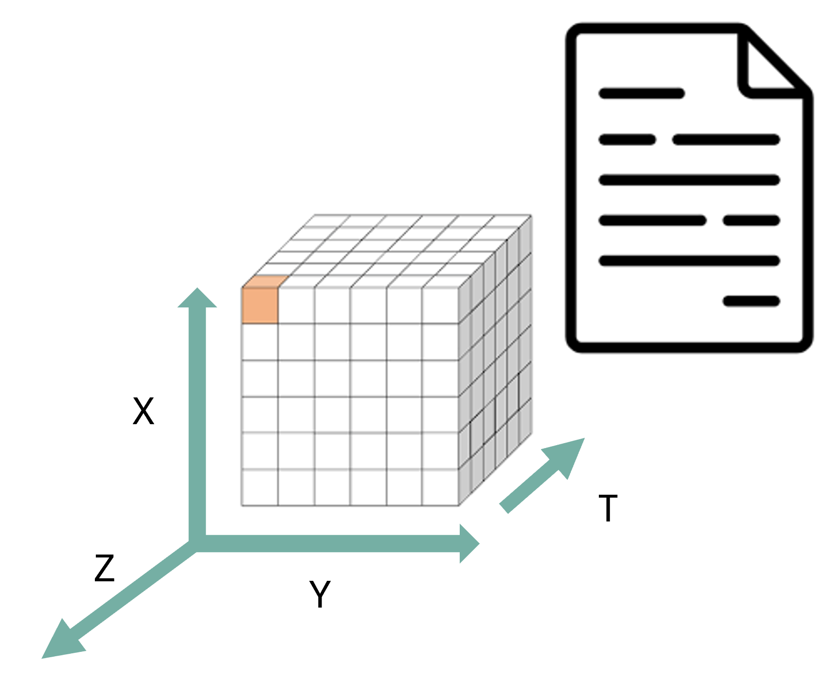
NetCDF is a family of data formats and software libraries built around a shared model for array-oriented scientific data.
The classic NetCDF data model contains three central elements:
-
Dimensions are named axes with a length, such as
time,latitude,longitude,height, orrange. - Variables are typed N-dimensional arrays whose shapes are defined by one or more dimensions.
- Attributes are small metadata values attached either to a variable or to the dataset as a whole.
The enhanced NetCDF-4 data model adds groups, additional data types, multiple unlimited dimensions, and user-defined types.
What NetCDF makes machine-actionable
A NetCDF reader can inspect:
- the names and lengths of dimensions;
- the names, data types, and shapes of variables;
- which dimensions are shared by multiple variables;
- variable-level and global attributes;
- fill values and storage encodings; and
- in NetCDF-4, groups and chunking information.
For example, the declaration
float air_temperature(time, latitude, longitude)states that air_temperature is a three-dimensional
floating-point array and that its axes are related to the dimensions
time, latitude, and
longitude.
What NetCDF does not guarantee by itself
NetCDF permits attributes to be added, but it does not require every producer to use the same names or scientific conventions. A file can be valid NetCDF while still using:
- ambiguous variable names;
- missing or non-standard units;
- unclear coordinate relationships;
- undocumented grid mappings; or
- inconsistent missing-value practices.
For climate and atmospheric data, CF Conventions define additional rules for identifying coordinate variables, auxiliary coordinates, standard names, units, grid mappings, cell bounds, and other scientific metadata.
Therefore:
NetCDF provides the structural container and core array data model; CF provides a more specific community contract for using that structure.
Other structural standards in climate and atmospheric workflows
Zarr: chunked arrays across storage systems
Zarr represents arrays and groups in a hierarchy. Its metadata describes array shape, data type, fill value, chunk grid, chunk-key encoding, and codecs. The chunks and metadata can be stored in a local directory, an object store, or another key-value store.
This supports:
- independent retrieval of chunks;
- lazy and parallel computation;
- cloud and distributed storage; and
- access without downloading an entire dataset.
Zarr provides a strong storage-level structural contract. However, arbitrary user attributes are allowed, and dimension names may be omitted. Climate workflows therefore still depend on conventions used by libraries such as xarray and, where appropriate, CF-compatible metadata practices.
Parquet: typed, column-oriented tables
Apache Parquet is designed for efficient storage and retrieval of tabular and nested data. It records a schema and physical data types, stores values by column, and supports compression and selective reads.
It is well suited to:
- station observations;
- event and trajectory records;
- large time-series tables;
- metadata catalogues; and
- analytical queries that select a subset of columns or rows.
Parquet provides stronger typing than CSV, but domain metadata such as units, quality flags, controlled variable names, and coordinate reference systems still needs an agreed convention.
GRIB2: operational meteorological fields
GRIB2 is maintained through the WMO Manual on Codes. It represents gridded meteorological fields using standard message sections, templates, parameters, levels, time-processing information, and code tables.
Its strict structure is valuable for operational exchange because receiving systems can decode forecast and analysis fields using WMO-managed templates and identifiers. The same specialisation can make GRIB less flexible for research datasets that require extensive custom metadata or many related variables in one exploratory dataset.
GeoTIFF and COG: georeferenced rasters
GeoTIFF defines requirements for storing georeferencing and geocoding information inside TIFF files. This allows GIS and remote-sensing tools to interpret both the pixel grid and its location in a coordinate reference system.
Cloud Optimized GeoTIFF adds an internal organisation suitable for efficient remote access. Tiling, overviews, and byte ordering allow clients to request only the parts needed for a particular spatial window or resolution.
COG demonstrates that structural interoperability can include not only logical data organisation, but also a standardised physical layout that enables predictable access behaviour.
Identify the structural elements in a NetCDF dataset
Open the OPeNDAP inspection page for the IDRA dataset:
Identify:
- the global attributes;
- the dimensions and their lengths;
- the coordinate variables;
- three data variables and their dimensions;
- the data types of those variables;
- one variable-level attribute that controls the interpretation of missing data; and
- any variables that store metadata as data values rather than as global attributes.
1. Global attributes
The dataset-level attributes include:
titleinstitutionhistoryreferencesConventionslocationsourceexample
The Conventions attribute declares CF-1.4.
This is a claim that the file follows a specific community convention;
conformance should still be checked rather than assumed solely from the
declaration.
2. Dimensions
The OPeNDAP Data Descriptor Structure shows the following dimensions:
time_raw_data = 73728sample_beat_signal = 1024time_processed_data = 144range = 512scalar = 1
3. Coordinate variables
The variables whose names match their dimensions are:
time_raw_data(time_raw_data)sample_beat_signal(sample_beat_signal)time_processed_data(time_processed_data)range(range)
The scalar dimension does not have a variable named
scalar; it is used as a length-one dimension by several
scalar-valued variables.
4. Example data variables and dimensions
i_hh(time_raw_data, sample_beat_signal)noise_power_horizontal(range)equivalent_reflectivity_factor(time_processed_data, range)radial_velocity(time_processed_data, range)azimuth_processed_data(time_processed_data)
5. Example data types
-
i_hhis stored as a 16-bit integer. -
time_processed_datais stored as a 64-bit real number. -
equivalent_reflectivity_factoris stored as a 32-bit real number. -
rangeis stored as a 32-bit integer.
6. Missing-data attribute
Several processed radar variables, including
equivalent_reflectivity_factor,
differential_reflectivity, radial_velocity,
and spectrum_width, declare:
_FillValue: -999.0The location and type of _FillValue are structural.
Whether missing observations should be excluded, interpolated, or
interpreted in another way is part of the analytical workflow.
7. Metadata stored as variables
The dataset also contains string variables such as:
iso_datasetproductstation_details
These are variables containing structured descriptive text. They should not be confused with the global attributes shown at the top of the OPeNDAP page.
The file is structurally inspectable because software can identify named dimensions, typed variables, shared axes, and attached attributes. However, its usefulness across workflows also depends on how consistently the declared CF convention and variable metadata are applied.
Can Ash compare two radar files from different years?
Ash wants to compare two IDRA radar datasets: one from 27 April 2009 and one from 2 January 2019.
Both are NetCDF datasets from the same radar system and are available through OPeNDAP. These shared technologies make them easier to inspect with the same tools, but they do not prove that the files are structurally equivalent.
Ash should compare the following structural properties before combining them:
- variable names and data types;
- dimensions, dimension order, and lengths;
- coordinate variables and coordinate values;
- fill values and missing-data encodings;
- units and scaling attributes;
- declared metadata conventions;
- variables available in one file but absent from the other; and
- whether the same logical quantity is represented by compatible arrays.
For example, two variables can both be named
radial_velocity but still differ in dimension order, units,
fill values, or coordinate grids. Conversely, two structurally
compatible variables can use different names and require an explicit
renaming step.
This comparison exposes three separate questions:
- Technical interoperability: Can the same tools and protocol open both datasets?
- Structural interoperability: Do the arrays, dimensions, coordinates, types, and metadata locations follow compatible rules?
- Semantic interoperability: Do the variables represent comparable physical quantities, units, reference systems, and measurement procedures?
Structural interoperability reduces the amount of custom code needed to answer these questions, but it does not remove the need for scientific judgement.
- Structural interoperability is a shared contract about how data objects are organised, encoded, related, typed, and validated.
- A file extension alone does not provide that contract.
- Data models, encodings, schemas, conventions, and access methods play different roles and should not be treated as synonyms.
- CSV and TSV are broadly portable but weakly self-describing; explicit dialects and machine-readable schemas make them substantially more interoperable.
- The most appropriate structural format depends on the data model: tables, multidimensional arrays, meteorological messages, rasters, or geospatial feature collections.
- Rich containers such as HDF5 do not guarantee interoperability unless communities agree on how their internal structures are used.
- NetCDF provides a shared multidimensional array data model; CF Conventions provide additional rules for climate and forecast metadata.
- Zarr standardises chunked array storage, while additional conventions are still needed to express scientific relationships consistently.
- Open specifications, independent implementations, validation, versioning, and transparent extension rules support long-term interoperability.
- Structural interoperability makes data machine-actionable, but semantic interoperability is still required to determine whether scientific quantities are meaningfully comparable.